USGS Topographic Map Indices
Last update · Never
Category: Indices Data Type: Polygon GIS data Stewards: UGRC & U.S. Geological Survey
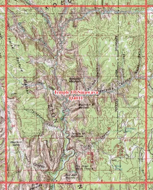
USGS Topographic Map boundary tile indices can be used to determine the 7.5 minute - 1:24,000, 30x60 minute - 1:100,000, 1x1 and 1x2 degree - 1:250,000 scale map boundaries for Utah.

Use the USGS 24K quad boundaries indices
Explore and Download
Utah USGS 24K Quads , opens in a new tab in the SGID on ArcGIS Utah USGS 24K Quads feature service , opens in a new tabQuick clips
Feature service URL
https://services1.arcgis.com/99lidPhWCzftIe9K/ArcGIS/rest/services/USGS24KQuads/FeatureServer/0 Open SGID sample query
select * from indices.usgs_24k_quads limit 10; Getting started
Learn more about the SGID on ArcGIS.
Learn more about the Open SGID and how to connect.
Tip
You can copy and paste the feature service URL above into ArcGIS Pro or a web map to visualize this data or access
the query endpoint to query the data with your favorite programming language.
Use the USGS 24K quarter quad boundaries indices
Explore and Download
Utah USGS 24K Quarter Quads , opens in a new tab in the SGID on ArcGIS Utah USGS 24K Quarter Quads feature service , opens in a new tabQuick clips
Feature service URL
https://services1.arcgis.com/99lidPhWCzftIe9K/ArcGIS/rest/services/USGS24KQuarterQuads/FeatureServer/0 Open SGID sample query
select * from indices.usgs_24k_quarter_quads limit 10; Getting started
Learn more about the SGID on ArcGIS.
Learn more about the Open SGID and how to connect.
Tip
You can copy and paste the feature service URL above into ArcGIS Pro or a web map to visualize this data or access
the query endpoint to query the data with your favorite programming language.
Use the USGS 100K quad boundaries indices
Explore and Download
Utah USGS 100K Quads , opens in a new tab in the SGID on ArcGIS Utah USGS 100K Quads feature service , opens in a new tabQuick clips
Feature service URL
https://services1.arcgis.com/99lidPhWCzftIe9K/ArcGIS/rest/services/USGS100KQuads/FeatureServer/0 Open SGID sample query
select * from indices.usgs_100k_quads limit 10; Getting started
Learn more about the SGID on ArcGIS.
Learn more about the Open SGID and how to connect.
Tip
You can copy and paste the feature service URL above into ArcGIS Pro or a web map to visualize this data or access
the query endpoint to query the data with your favorite programming language.
Use the USGS 250K quad boundaries 1x1 indices
Explore and Download
Utah USGS 250K Quads 1x1 , opens in a new tab in the SGID on ArcGIS Utah USGS 250K Quads 1x1 feature service , opens in a new tabQuick clips
Feature service URL
https://services1.arcgis.com/99lidPhWCzftIe9K/ArcGIS/rest/services/USGS250KQuads1x1/FeatureServer/0 Open SGID sample query
select * from indices.usgs_250k_quads_1x1 limit 10; Getting started
Learn more about the SGID on ArcGIS.
Learn more about the Open SGID and how to connect.
Tip
You can copy and paste the feature service URL above into ArcGIS Pro or a web map to visualize this data or access
the query endpoint to query the data with your favorite programming language.
Use the USGS 250K quad boundaries 1x2 indices
Explore and Download
Utah USGS 250K Quads 1x2 , opens in a new tab in the SGID on ArcGIS Utah USGS 250K Quads 1x2 feature service , opens in a new tabQuick clips
Feature service URL
https://services1.arcgis.com/99lidPhWCzftIe9K/ArcGIS/rest/services/USGS250KQuads1x2/FeatureServer/0 Open SGID sample query
select * from indices.usgs_250k_quads_1x2 limit 10; Getting started
Learn more about the SGID on ArcGIS.
Learn more about the Open SGID and how to connect.
Tip
You can copy and paste the feature service URL above into ArcGIS Pro or a web map to visualize this data or access
the query endpoint to query the data with your favorite programming language.
A closer look
The 24K tile index contains the following attribute fields:
- Name - the name of the map
- OHIO_CODE - code used by USGS
- TILE - the UGRC q number tile name
The 100K tile index contains the following attribute fields:
- Name - the name of the map
- TILE - the UGRC q number tile name
The 250K tile indices contains the following attribute fields:
- USGS_CODE - code used by USGS
- TILE_NAME - the UGRC q number tile name
The native spatial reference for these dataset are UTM Zone 12N, NAD83 (0.01 meter coordinate precision). There are no constraints or warranties with regard to the use of this dataset. Users are encouraged to attribute content to: State of Utah, SGID.